AMN PLUS-August 4, 2026
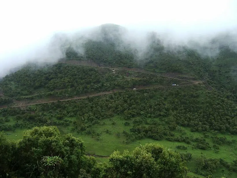
Ethiopia’s Green Legacy Initiative (GLI) is one of Africa’s most ambitious environmental campaigns, aiming to plant over 65 billion trees across the country by 2030 to combat climate change, restore degraded lands, and enhance biodiversity. Launched in 2019, the initiative has garnered national and international recognition for its scale and impact, with millions of citizens participating in mass tree-planting campaigns.
However, managing such a massive reforestation effort requires innovative approaches to ensure its success, sustainability, and accountability. To this end, Ethiopia has integrated cutting-edge geospatial technology, cloud computing platforms like Google Earth Engine, and satellite imagery from Landsat and Sentinel-2 to monitor, evaluate, and optimize its green growth strategies.
One of the primary challenges in large-scale reforestation is accurately tracking progress and assessing the survival and growth of millions of newly planted trees. Traditional ground surveys, though valuable, are time-consuming, labor-intensive, and often impractical at such a grand scale. Ethiopia’s adoption of remote sensing technologies has revolutionized this process. Satellite imagery provides high-resolution, multispectral data that allows authorities to digitally map planting sites and nurseries with precise geographic coordinates. Using platforms like Google Earth Engine, analysts can process and analyze this data swiftly, enabling real-time monitoring of vegetation changes across the country.
Vegetation health is assessed using indices such as the Normalized Difference Vegetation Index (NDVI), which quantifies greenness and photosynthetic activity. By analyzing NDVI data over time, officials can determine which areas have successfully established forest cover and which ones require intervention. For example, through NDVI analysis, Ethiopia has been able to verify that regions like Oromia, Amhara, and areas in the southern part of the country have seen significant canopy development, with NDVI values increasing by up to 25% in some areas since the inception of the initiative.
Furthermore, machine learning algorithms—such as the Random Forest classifier—are employed to analyze satellite imagery and detect land cover changes accurately. These algorithms distinguish between natural vegetation, planted trees, agricultural land, and urban areas, providing detailed insights into the extent of land reforested. For instance, recent analyses show that Ethiopia has expanded its forest cover by approximately 4% since 2019, translating to roughly 1.2 million hectares of newly planted or regenerated forest area. These figures substantiate the initiative’s progress and serve as a baseline for future efforts.
Equally important is quantifying the environmental benefits of Ethiopia’s reforestation efforts. Satellite-based measurements of Land Surface Temperature (LST) reveal that forested areas contribute to local cooling. Studies indicate that in regions with successful tree planting, LST has decreased by up to 2°C, which helps mitigate the urban heat island effect and reduces energy costs associated with cooling. Additionally, water indices like the Normalized Difference Water Index (NDWI) confirm improvements in water retention and soil moisture levels, which are crucial for the survival of young trees and the overall health of ecosystems.
The data collected through these technologies also reveal regional challenges. For example, areas with low tree survival rates—sometimes less than 50%—are often affected by moisture stress, pests, or human disturbances. These insights enable Ethiopian authorities to target water conservation measures, soil protection, and community engagement efforts more effectively. For instance, in drought-prone regions like Afar and parts of Somali, supplemental water sources and drought-resistant tree species are being prioritized to improve survival rates.
Digital monitoring and evaluation not only improve the accuracy of progress reports but also enhance transparency and accountability. The Ethiopian government can demonstrate tangible results to its citizens and international partners, securing ongoing support and funding. Since the launch of the Green Legacy, Ethiopia has planted over 53 billion trees, and satellite data continues to show positive trends in forest expansion.
In short, Ethiopia’s application of geospatial technology, satellite imagery, and machine learning has played a pivotal role in scaling and sustaining its Green Legacy Initiative. These tools provide vital data to measure progress, assess environmental impacts, and address regional challenges effectively. As the country moves toward its 2030 goal, leveraging innovative digital solutions will be essential in ensuring that Ethiopia’s reforestation efforts are not only ambitious but also sustainable, impactful, and transparent—setting an inspiring example for other nations tackling climate change and environmental degradation, according to pulse of Africa.